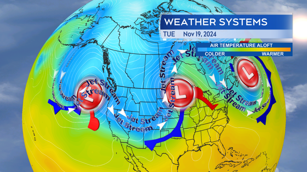
A trifecta of storm systems is impacting Canada this week. A “bomb” cyclone is bringing severe wind to coastal B.C., while a Texas low has triggered snow and winter storm warnings in Manitoba and Saskatchewan. On the east coast, a stalled area of low pressure has put Atlantic Canada into several days of cloudy, damp, and windy weather.
They are three storms with varying weather conditions, but they all have one thing in common — they are all caught up in a jet stream pattern that is slowing them down and prolonging impacts.
Polar jet streams
The polar jet stream is a band of strong wind that wraps around the northern hemisphere at a height of about nine kilometers in the atmosphere.
These high-level winds are important for steering the surface pressure systems that are responsible for much of our weather.
When the jet stream is positioned relatively straight west-to-east (zonal), it favours a quicker movement of those weather systems. When the jet stream is set into a pattern of rises to the north (ridges) and dips to the south (troughs), it favours a slow progression and even stall of those weather systems. That type of pattern in the jet stream is referred to as “meridional”, as in moving towards and away from the meridian.
The jet stream pattern this week is the latter.
Three large storms systems are impacting the country on Tuesday. High wind for coastal B.C., heavy snow in parts of the Prairies, a prolonged period of dreary and gusty weather for Atlantic Canada. (CTV/Kalin Mitchell)
Stalling storms
A trough off the coastline of B.C., ridge over northern Ontario, and a trough across Atlantic Canada in the jet stream is slowing the progress of storm systems across the country.
The impact to B.C. will be a prolonged period of severe wind for coastal areas starting Tuesday night and extending into Wednesday.
The impact to western Manitoba and eastern Saskatchewan will be a snowfall that is already underway extending through Wednesday. That will allow for some accumulations of 15 to 40 cm. A gusty northerly wind accompanying the snow producing periods of near white out conditions as it falls.
Atlantic Canada has been held in a several day weather pattern of windy and damp weather. The wind at times reaching a high enough speed to disrupt travel services such as ferries and restricting traffic on the Confederation Bridge.

Change ahead
In order to break this pattern of slow-moving storms, the wrinkles in the jet stream must be ironed out.
A much more “zonal” jet stream pattern is likely to develop across the country by the end of the upcoming weekend. That pattern then looks to extend through the end of next week. That should make for briefer periods of inclement weather interspersed with fairer conditions.

